(WORK) ✶ CITIES, DATA, AND PEOPLE
URBAN PLANNING
✶
URBAN PLANNING
✶
(SCROLL) ↓
The soul of a city lies deep within imperceptible breaths of human life. Its streets hold chronicles of ordinary days, written in familiar journeys and doorways worn smooth by generations. Urban planning draws me into these stories, where a mathematical model or a line of code might help explain how a neighborhood moves, and an engineering decision changes how it feels to live there. I want to explore how computation and artificial intelligence can help us read those patterns, finding more harmonious ways for a city to grow around the lives already within it.
The soul of a city lies deep within imperceptible breaths of human life. Its streets hold chronicles of ordinary days, written in familiar journeys and doorways worn smooth by generations. Urban planning draws me into these stories, where a mathematical model or a line of code might help explain how a neighborhood moves, and an engineering decision changes how it feels to live there. I want to explore how computation and artificial intelligence can help us read those patterns, finding more harmonious ways for a city to grow around the lives already within it.
(01) INTERNSHIP ✶
VIUP ✶ GIS ✶ CAD ✶ QUANG NINH 2050

INTERNSHIP
INTERNSHIP
VIETNAM INSTITUTE FOR URBAN AND RURAL PLANNING (VIUP)
VIETNAM INSTITUTE FOR URBAN AND RURAL PLANNING (VIUP)
(A) TEACHING MYSELF THE TOOLS
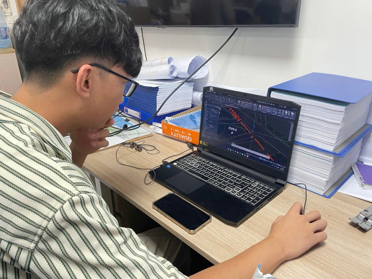
At the Vietnam Institute for Urban and Rural Planning (VIUP), I taught myself ArcGIS Pro and AutoCAD to convert planning documents and spatial data into GIS layers and editable CAD drawings for use across departments. Connecting those layers helped me examine site constraints alongside proposed development, turning separate records into a clearer picture of the planning challenges within each study area.
At the Vietnam Institute for Urban and Rural Planning (VIUP), I taught myself ArcGIS Pro and AutoCAD to convert planning documents and spatial data into GIS layers and editable CAD drawings for use across departments. Connecting those layers helped me examine site constraints alongside proposed development, turning separate records into a clearer picture of the planning challenges within each study area.
(B) QUANG NINH 2050, VISION 2075
For the Quang Ninh Urban Masterplan to 2050, with a vision to 2075, I reviewed planning policies and climate-adaptation precedents from Singapore, Copenhagen and Rotterdam. Under the team’s guidance, I processed spatial data to visualize where development could integrate with natural water systems across Quang Ninh’s mountain, bay and island geography. This informed my participation in discussions on a locally adapted sponge-city approach, including rain gardens and mangrove restoration within a wider green-blue network. Elements of my literature review and visualizations were incorporated into preliminary reports.
For the Quang Ninh Urban Masterplan to 2050, with a vision to 2075, I reviewed planning policies and climate-adaptation precedents from Singapore, Copenhagen and Rotterdam. Under the team’s guidance, I processed spatial data to visualize where development could integrate with natural water systems across Quang Ninh’s mountain, bay and island geography. This informed my participation in discussions on a locally adapted sponge-city approach, including rain gardens and mangrove restoration within a wider green-blue network. Elements of my literature review and visualizations were incorporated into preliminary reports.
(C) DIGITAL TWIN SEMINARS
In smart-city and digital-twin seminars with Japanese architects and consultants, I explored what it would take to move from a digital model to a system local institutions could operate and maintain. I raised questions about institutional capacity and residents’ access, and joined discussions on simplifying GIS maps so communities could understand planning proposals and submit feedback. The technical challenge became more compelling when I considered who would need to use the result.
In smart-city and digital-twin seminars with Japanese architects and consultants, I explored what it would take to move from a digital model to a system local institutions could operate and maintain. I raised questions about institutional capacity and residents’ access, and joined discussions on simplifying GIS maps so communities could understand planning proposals and submit feedback. The technical challenge became more compelling when I considered who would need to use the result.



(02) MANUSCRIPT ✶
INFORMAL RECYCLING ✶ ĐỒNG NÁT ✶ EPR
INFORMAL RECYCLING ✶ ĐỒNG NÁT ✶ EPR
MANUSCRIPT
MANUSCRIPT

(A) THE RESEARCH
Working with Dr. Nguyen Thai Huyen of Hanoi Architectural University and Dr. Take Kyoko of Japan’s Institute for Global Environmental Strategies, I contributed to results analysis and manuscript refinement for research on Vietnam’s informal recycling networks.
Working with Dr. Nguyen Thai Huyen of Hanoi Architectural University and Dr. Take Kyoko of Japan’s Institute for Global Environmental Strategies, I contributed to results analysis and manuscript refinement for research on Vietnam’s informal recycling networks.
(B) THE ARGUMENT
Our discussions centered on how đồng nát (scrap aggregators) function as distributed urban infrastructure, sustaining material recovery through neighborhood networks and established trading relationships. Drawing on survey data, 37 interviews and policy analysis, we examined system-policy misalignment: Extended Producer Responsibility (EPR) frameworks assume registered businesses and traceable transactions, while existing recovery networks often rely on cash exchanges and personal trust. We explored how hybrid governance could connect these networks with formal institutions while improving workers’ social protection and bargaining power.
Our discussions centered on how đồng nát (scrap aggregators) function as distributed urban infrastructure, sustaining material recovery through neighborhood networks and established trading relationships. Drawing on survey data, 37 interviews and policy analysis, we examined system-policy misalignment: Extended Producer Responsibility (EPR) frameworks assume registered businesses and traceable transactions, while existing recovery networks often rely on cash exchanges and personal trust. We explored how hybrid governance could connect these networks with formal institutions while improving workers’ social protection and bargaining power.
(03) URBANSENSE ✶
HANDHELD ✶ ESP32-S3 ✶ WALKABILITY
URBANSENSE
URBANSENSE
A map tells me a destination is fifteen minutes away, but little about how the walk might feel.
A map tells me a destination is fifteen minutes away, but little about how the walk might feel.


(A) THE QUESTION
A map tells me a destination is fifteen minutes away, but little about how the walk might feel. Will there be shade, or heavy air beside a busy road? Moving between Hanoi and Singapore has made me curious about what makes a walk worth choosing.
A map tells me a destination is fifteen minutes away, but little about how the walk might feel. Will there be shade, or heavy air beside a busy road? Moving between Hanoi and Singapore has made me curious about what makes a walk worth choosing.
Singapore’s recent haze situation caused by Sumatra wildfires brought that curiosity into sharper focus. A clear pavement tells us quite little about the air above it. I wanted to investigate conditions at the scale of a walk, collecting observations that I could place along the route itself. That became the starting point for UrbanSense.
Singapore’s recent haze situation caused by Sumatra wildfires brought that curiosity into sharper focus. A clear pavement tells us quite little about the air above it. I wanted to investigate conditions at the scale of a walk, collecting observations that I could place along the route itself. That became the starting point for UrbanSense.
(B) THE DEVICE
UrbanSense is a handheld device built around an ESP32-S3, combining a BME680 environmental sensor with an MQ-135 gas sensor and BH1750 light sensor. A NEO-6M GPS tags readings by location, while microSD storage and an LCD support on-the-go monitoring. Connected to a server that draws on NEA weather data, it helps me investigate environmental conditions along walking routes.
UrbanSense is a handheld device built around an ESP32-S3, combining a BME680 environmental sensor with an MQ-135 gas sensor and BH1750 light sensor. A NEO-6M GPS tags readings by location, while microSD storage and an LCD support on-the-go monitoring. Connected to a server that draws on NEA weather data, it helps me investigate environmental conditions along walking routes.
Together with my friend Jiwoo Lee, I analyzed the raw sensor data and co-authored a report of our findings. The report gave us a way to move beyond individual readings and ask what the observations might mean for pedestrian comfort. As we develop UrbanSense further, I want to understand what makes an ordinary walk inviting enough to choose again.
Together with my friend Jiwoo Lee, I analyzed the raw sensor data and co-authored a report of our findings. The report gave us a way to move beyond individual readings and ask what the observations might mean for pedestrian comfort. As we develop UrbanSense further, I want to understand what makes an ordinary walk inviting enough to choose again.
(04) PHOTOGRAPHY ✶
THE CITY IMPROVISES
PHOTOGRAPHY
PHOTOGRAPHY
A wise man once said a picture is worth a thousand words. I suspect cities usually need a few more.
A wise man once said a picture is worth a thousand words. I suspect cities usually need a few more.
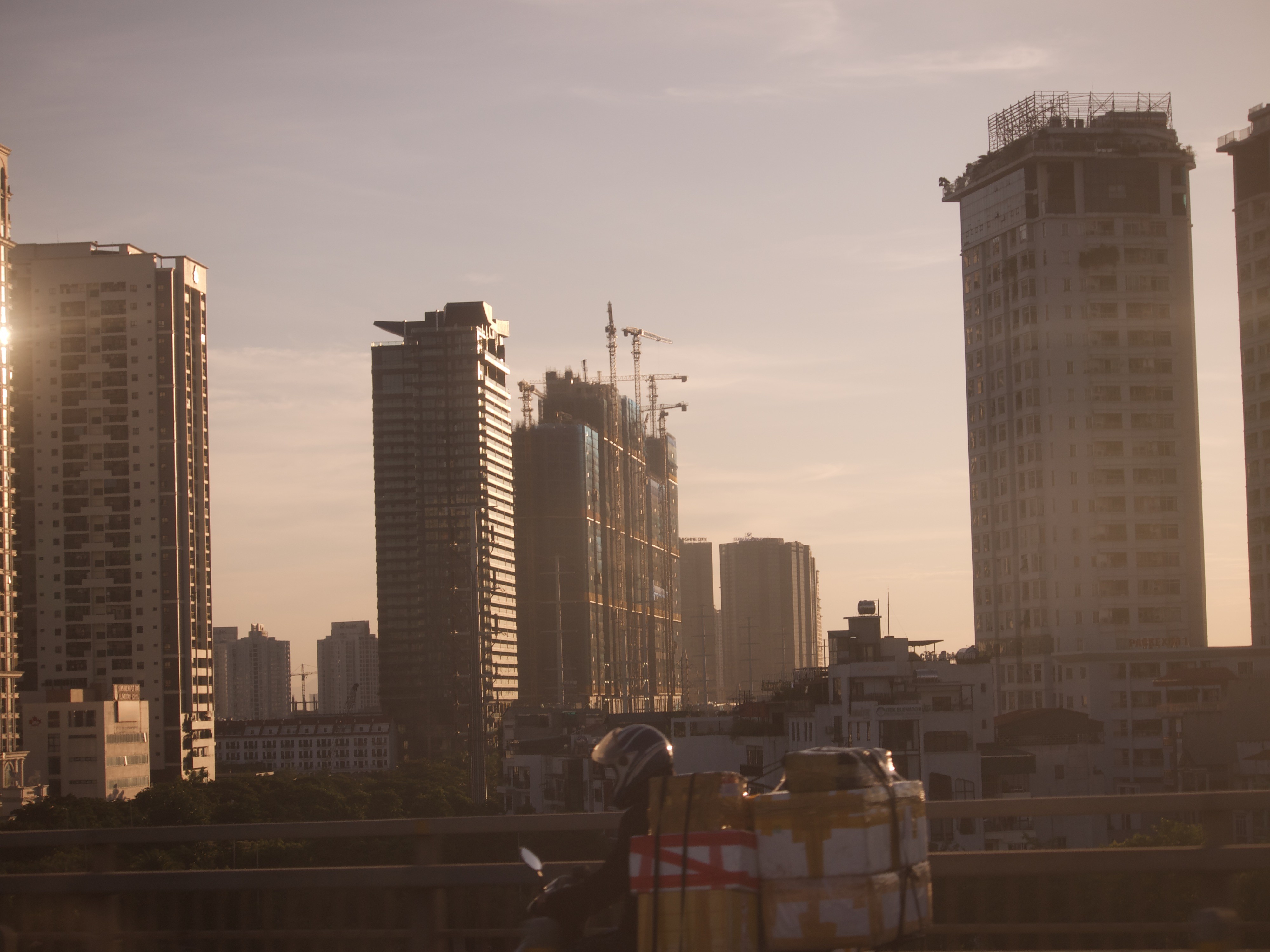
Photography became one of the ways I learned to read them. I found myself drawn not to the polished image of a city, but to moments when it revealed itself by accident: when order loosens, something unexpected takes its place, and the city begins to improvise. Sometimes that only becomes visible from far above; sometimes it is hiding in plain sight.
Photography became one of the ways I learned to read them. I found myself drawn not to the polished image of a city, but to moments when it revealed itself by accident: when order loosens, something unexpected takes its place, and the city begins to improvise. Sometimes that only becomes visible from far above; sometimes it is hiding in plain sight.
THE FOLLOWING CAROUSEL COLLECTS THOSE MOMENTS
(01 / 16)


Click Here To See
Click Here To See
✶
✶
✶
✶
HOME
CASES
STUDIO
SERVICES
LABS
MENU ✶